Information for visitors to Hawaiʻi island
A summit eruption of Mauna Loa volcano began on 27 November 2022 and there is an ongoing eruption at Kīlauea volcano's summit. There is currently no lava erupting outside of the summit areas of either volcano, and no homes, structures, or highways are threatened. (Last updated 28 November 2022)
For the latest eruption information:
US Geological Survey eruption updates
Hawai'i County active alerts
What is happening at Mauna Loa Volcano?
- Summit activity: A new eruption starting during the evening of 27 November 2022. At the time of writing (28 November) the lava is confined to the summit caldera but the U.S. Geological Survey are monitoring the volcano for any changes.
What is happening at Kīlauea Volcano?
- Summit activity: This eruption at Kīlauea's summit is occurring within a closed area of Hawaiʻi Volcanoes National Park. High levels of volcanic gas are the primary hazard of concern, as this hazard can have far-reaching effects downwind. Large amounts of volcanic gas—primarily water vapor (H2O), carbon dioxide (CO2), and sulfur dioxide (SO2)—are continuously released during eruptions of Kīlauea Volcano. As SO2 is released from the summit, it reacts in the atmosphere to create the visible haze known as vog (volcanic smog) that has been observed downwind of Kīlauea. Vog creates the potential for airborne health hazards to residents and visitors, damages agricultural crops and other plants, and affects livestock. For more information on gas hazards at the summit of Kīlauea, please see: https://pubs.er.usgs.gov/publication/fs20173017. Vog information can be found on this Dashboard.
How are these eruption affecting visitors?
- Mauna Loa - at the time of writing, no information has been given in relation to the Mauna Loa eruption. Please check back for updates.
- Hawai‘i Volcanoes National Park: Currently, no active lava can be viewed from any publicly accessible areas of Hawai‘i Volcanoes National Park (HVNP); however, during evening hours, the glow from the molten lava can be observed. Viewing the eruption is very popular and HVNP has had an increase in visitors. Please stay informed, follow safety guidelines, avoid crowding, and mālama ʻāina (care for the land). Be sure to check current HVNP Alerts & Conditions before visiting. The summit area and Kahuku Unit can be impacted by hazardous volcanic gas, particles, and ashfall. Individuals with pre-existing respiratory conditions should have their medications available when visiting the Park, as conditions can change rapidly and air quality can reach unhealthy levels very quickly. It is important to follow precautions to avoid the transmission of COVID-19. Do not visit the park if you feel unwell. The National Historic Parks in West Hawai‘i are open as usual.
- Air quality impacts: Volcanic pollution on the island is an ongoing condition that accompanies the eruption of Kīlauea, and now Mauna Loa, and has been present over the last 35 years. Volcanic pollution is mainly composed of:
- SO2 gas and fine particles (PM2.5), also known as vog, from Kīlauea’s fissure and summit eruptions. Fine particles are largely responsible for the visible haze observed downwind of the vents and along the Kona coast.
- Ash particles from the summit ash explosions and emissions.
- Laze: the acidic steam plume generated when lava flows into the ocean. This plume is laden with hydrochloric acid and volcanic glass particles, but is local to the area around the ocean entry site. Laze is not being produced in the 2020 eruption.
- Smoke from vegetation being burned by lava flows.
- Volcanic glass: generally local to the area around the fissures.
How bad is the air quality?
- The distribution of volcanic pollution on Hawai‘i island is controlled by wind speed and direction. Prevailing northeasterly trade winds blow volcanic emissions to the southwest, where they wrap around the southern part of the island, and are trapped by daytime onshore and nighttime offshore sea breezes along the Kona coast.
- Air quality north of Kailua-Kona is less frequently impacted by volcanic pollution under these conditions (see Figure 2).
- When trade winds are absent, volcanic pollution may affect East Hawai‘i, the entire island, or State.
- The areas surrounding Kīlauea Volcano’s summit, and directly downwind, are most likely to be impacted by ashfall. However, large events may affect areas much further away. Ash was reported 10s of miles away from the Kīlauea summit during the 1924 and 2018 explosive summit eruptions. Ashfall has not been a significant hazard outside of the summit area during the 2020 eruption.
- Other areas on Hawai‘i island can experience gas and particle concentrations that reach the Hawaii State Department of Health ‘moderate’, ‘unhealthy for sensitive groups’ or ‘unhealthy’ categories, depending on wind conditions.
Where can I find air quality data and forecasts so that I can see for myself?
What are the health impacts of being exposed to vog?
- SO2 gas is a strong irritant that can be a concern, especially to those that are particularly ‘sensitive’ like people with pre-existing respiratory disorders (e.g. asthma) or cardiovascular disease. Please see the health effects of vog page to learn about the possible health impacts and who is most likely to be affected.
- Please see the health impacts of volcanic ash pamphlet to learn more about exposure to volcanic ash.
Can you tell me if I should come to Hawai‘i?
- Large portions of Hawai‘i Island, as well as the rest of the State, are generally not impacted by the current eruptive activity. The above information has been written to help you make an informed decision based on current conditions. If you have specific health concerns, please discuss the above information with your medical practitioner.
- The Vog Talk Facebook group provides a venue for community members to share information.
- The Hawaii Tourism Authority (HTA) provides up-to-date information on traveling to Hawai'i.
Resources
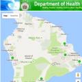 1. Hawaiʻi short term SO2 advisory
Hawaii Department of Health (HDOH)
Current SO2 levels across the Island of Hawaiʻi.
http://www.hiSO2index.info
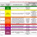 Hawai'i Department of Health SO2 advisory levels
Recommended actions/activities at specific SO2 concentrations/color codes.
www.hiSO2index.info/assets/FinalSO2Exposurelevels.pdf
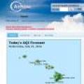 2. AirNow particle data
Federal, State and tribal consortium
Air Quality Index (AQI) based on PM2.5 particle real-time monitoring data and recommended actions at specific AQI advisory levels.
www.airnow.gov/state/?name=Hawaii
www.airnow.gov/sites/default/files/2020-03/air-quality-guide_pm_2015.pdf
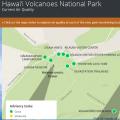 3. Current SO2 and PM2.5 conditions in Hawai'i Volcanoes National Park
National Park Service (NPS)
Map showing approximate location of the Halemaʻumaʻu gas plume, SO2 concentrations (ppm) at 10 locations, and PM2.5 at 4 locations in the Park.
www.hawaiiso2network.com
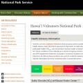 4. National Park Service webcam and recent air quality data
National Park Service (NPS)
Graphical displays of air quality data (SO2, PM2.5), weather and webcam in Hawai'i Volcanoes National Park
www.nps.gov/subjects/air/webcams.htm?site=havo
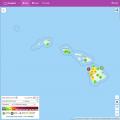 5. PurpleAir real-time air quality map
Community-based monitoring network
A low-cost sensor network providing real time measurement of air quality on a public map.
www.purpleair.com/map


 1. Hawaiʻi short term SO2 advisory
 Hawai'i Department of Health SO2 advisory levels
 2. AirNow particle data
 3. Current SO2 and PM2.5 conditions in Hawai'i Volcanoes National Park
 4. National Park Service webcam and recent air quality data
 5. PurpleAir real-time air quality map