


A variety of satellite based instruments provide SO2 and particle data for volcanoes worldwide, including Hawaii:
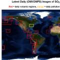 1. Latest daily (OMI/OMPS) satellite images of SO2 mass
NASA
Site includes daily SO2 mass plus archived and time series data
 2. Near real time OMI satellite images of SO2 mass
NOAA
Latest OMI SO2 column (5 km) images by volcano, plus cloud and aerosol index images.
http://satepsanone.nesdis.noaa.gov/pub/OMI/OMISO2/index.html
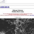 3. GOES-WEST satellite
NOAA
Used mostly for weather tracking, but also for volcanic gas emissions and lava flows. Images are acquired every 15 minutes.
http://www.ssd.noaa.gov/VAAC/kilauea/sloop-vis.html
 4. MODIS satellite
NASA
Passes over Hawai’i twice a day, and can be useful for tracking plumes.
http://rapidfire.sci.gsfc.nasa.gov/subsets/?subset=AERONET_Mauna_Loa
 5. SACS - Support to aviation control service
Consortium hosted by Belgian Institute for Space Aeronomy
Subscription service for image notification of volcanic gas and particle events from 5 instruments (OMI; Gome2; IASI; AIRS; Sciamachy)
 6. Tropomi
Consortium consisting of Airbus Defence and Space, KNMI, SRON and TNO
The TROPOspheric Monitoring Instrument (TROPOMI) has UV, UVIS, NIR and SWIR on board the Copernicus Sentinel-5 Precursor satellite which will come online later in 2016.
 7. NASA Earth Observatory
NASA
Various types of space-based images for Kilauea.
http://earthobservatory.nasa.gov/Search/index.php?hq=&q=kilauea+plume&sa=search
 Contact us or provide feedback
The Interagency Vog Dashboard is the result of a partnership between the International Volcanic Health Hazard Network (Durham University, UK), Hawaii State Department of Health, the USGS Hawaiian Volcano Observatory, Hawaiʻi County Civil Defense, the National Park Service, County of Hawaiʻi (Mayor's Office), CSAV (University of Hawaiʻi), NOAA (National Weather Service) and the US Department of Agriculture Farm Service Agency.
The Interagency Vog Dashboard was developed to implement recommendations from a collaborative study between Dr Claire Horwell and the USGS, funded by the British Council Researcher Links Programme and Durham University, UK.
Last updated: September 2024